


The area surrounding Lake Garda, which extends as far as the Morainic Hills and the high mountains above it, is a paradise for fans of these activities, not only because it offers extraordinary landscapes and an infinite number of routes of all types, but also because of the Mediterranean climate that allows these sports to be practised in all seasons and the widespread presence of refuges and mountain huts that always offer a warm welcome.
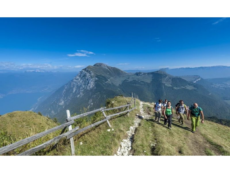
For lovers of nature and greenery, there is no lack of opportunities on Lake Garda to discover the hidden side of a landscape that goes off the usual tourist routes. In particular, if you are an experienced hiker, the route from Malcesine to Monte Baldo is just the thing for you.
This interesting walk consists of a long walk along the Ventrar path that will take you through gullies and cliffs, passing the Kira refuge, the San Valentino capital, and the Il Signor portico, all the way to the San Michele knoll, from where you can take the cable car home.
The Ventrar path is about one kilometre long, cuts across the north face of the Colma di Malcesine and leads to the east side of Monte Baldo. The landscape is sometimes rocky, sometimes panoramic with beautiful views of the Upper Garda. The route starts at the Tratto Spino cable car station. Head north and take the first climb to the left immediately after the cable car fence.
Continue north, cross the ski lift poles on the Donald Duck ski slope and, just past the slope, pay attention to the start of the path indicated by a red and white horizontal marker on a stone.
The path remains below the paragliding take-off area.
This path is narrow but easy, almost two kilometres long, mostly downhill and takes you to the junction with the Ventrar path. Turn right and enjoy this beautiful trail!
At the end of the Ventrar trail, you can return to your starting point by following the road on your left or by climbing the trail in front of you. The path is quite steep but short and takes you to the Colma di Malcesine, where you walk a few kilometres south on level ground and return to your starting point.
We suggest the path, although a bit more strenuous, but it takes you to the tip of the Colma di Malcesine where there are better views than on the road.
The Ventrar trail is closed in winter.
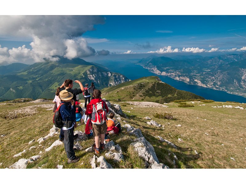
Moving further south, on the other hand, there are two itineraries, quite demanding but very beautiful and suggestive, that will introduce you to an unexpected Monte Baldo, with an Alpine flavour.
The first climbs to Cima Valdritta from path no. 5 and the second climbs to Cima Telegrafo from path no. 654.
If, on the other hand, you are spending your holiday in Torbole and would like to explore its surroundings, about one kilometre from the centre you will find Nago, where you can park and start a truly original walk. Following a path from there, you will have the chance to reach the Marmitte dei Giganti, natural cavities in the middle of the rocks, 10 to 12 metres deep. This original name comes from the legend that these meanders were hollowed out by colossal giants.
The Tibetan Bridge over Lake Garda is located near Torri del Benaco, on the Veneto side of the lake, and is an ideal destination if you want to take a different trip with the children.
The Tibetan bridge, opened in August 2019, joins the village of Pai di Sopra with Crero, in the middle of Val Vanzana.
It is a truly exciting place to visit. At 34 metres long and just over a metre wide, the Tibetan bridge near Torri del Benaco reaches a maximum height of around forty-five metres.
The bridge is made entirely of steel with anti-slip gratings to guarantee safety even for the smallest children. The walk across the Tibetan bridge is safe and stable, although there is always a minimum of sway, just enough to feel a little thrill.
It is possible to walk across the Tibetan bridge for up to 15 people at a time, while those arriving by bike can walk across the bridge carrying their bikes by hand.
This is a must-do excursion if you are on holiday or passing through on the eastern side of Lake Garda, because in addition to enjoying a truly breathtaking view, the Tibetan bridge also connects two important hiking trails, Cai path no. 38 and no. 39.
The Tibetan bridge was built not only to offer a thrill ride, but also to join the two paths, allowing the so-called 'senter de mes' or middle path, that stretch of road immersed in olive groves close to the lake and interrupted from Malcesine to Garda.
In fact, before there was the Tibetan bridge, one had to descend to the lake or climb to San Zeno di Montagna to continue the hiking route.
The Rocca di Garda is a relief located between the town of Garda (to the north) and the town of Bardolino (to the south) overlooking the waters of the lake of the same name.
It consists of two main summits, separated by a hill: the Rocca Vecchia (291 m.a.s.l.) and the Eremo di San Giorgio (306 m.a.s.l.).
The historical importance of this relief derives from the fact that a fortress (of which there are only a few masonry traces left) was erected on the summit in the 5th century B.C. in the Lombard era, which still gives the relief its name.
Trekking on the Rocca is an easy six-kilometre route that leads through the morainic hills of the first hinterland to the Hermitage of San Giorgio and then to the promontory of the Rocca Vecchia.
The enchanting route winds through woods, vineyards, farmhouses and fascinating archaeological, medieval and military remains.
Departing from Garda, you walk along Via Boschi to arrive at Località Dacia. From here you continue up towards the Hermitage of San Giorgio of the Benedictine Camaldolese monks, from here you descend slightly to the 291 metres above sea level of the Rocca Vecchia, immersed in the typical Garda landscape, an environment softened by rich Mediterranean vegetation.
From the Rocca Vecchia one enjoys a magnificent view in an oasis of peace and tranquillity. It is a vast esplanade, with beautiful meadows where one can rest or access various viewpoints that offer wonderful emotions.
From the Rocca the route descends, winding through the hills of the first hinterland, varying in altitude between vineyards and farmhouses, before reaching the centre of Garda once again.